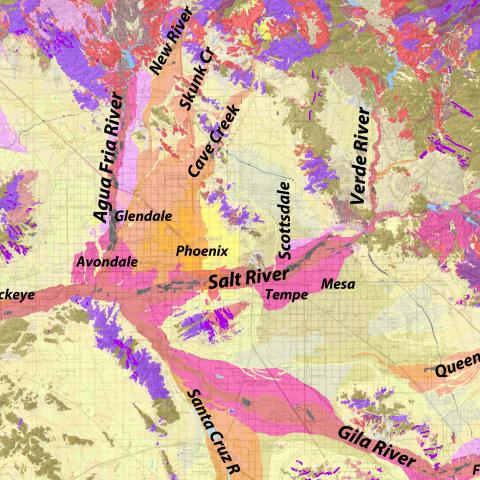
The Phoenix Metro Area, with nearly 5,000,000 people, has an insatiable appetite for construction-grade sand and gravel, collectively referred to as aggregate. Fortunately, that natural resource is close at hand in the washes and river systems (Gila River, Salt River, Agua Fria River, Hassayampa River, Cave Creek) that meander through Phoenix and environs. This geologic map by Phil Pearthree and others is a geotechnical tool for identifying outcrops of aggregate. You can download the "Geologic Map Database for Aggregate Resource Assessment in the Phoenix Metropolitan Area and Surrounding Regions, Arizona" map graphic, report and GIS database at: http://repository.azgs.az.gov/uri_gin/azgs/dlio/1640 .
Photographer: Unknown
Photo Date: circa 2016
Photo Location Accuracy: Known Location
Photo Tags: aggregate, industrial mineral, sand & gravel, construction, infrastructure, Salt River, Gila River, Agua Fria River, Phoenix, Phoenix Metro Area 


