Role of AZGS Outreach & Extension Service
 For over 125 years, the AZGS and its predecessors (e.g., Arizona Bureau of Mines) have served the geologic needs of the public, private enterprise and local, county, tribal, state and federal government.
A chief objective of our outreach and extension service is to inform our stakeholders regarding the geology, natural resources - notably mineral resources-, and natural hazards that threaten people, property and infrastructure.
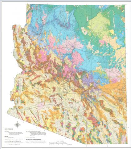
Going forward in 2018, we're leveraging digital pathways to deploy and promote our geologic reports, videos, maps and communications. Our principal outlet is this website, but there are a number of other digital venues which help us broker our message while fulfilling our mission.
Key Geo-Education Resources
As Arizona's Earth Science agency, we are directed by state statute to provide educational resources for Arizona's K-12 education community. Over the years, we deployed programs to assist teachers in teaching geosciences and geography. For example, until recently we hosted a 'Topographic Maps for Teachers' program, providing free topographic maps and lesson plans. While that program ended with our move to the University of Arizona, we are now building out digital geo-education tools for teachers.
Down-To-Earth! Our most popular geologic series for the lay public is our collection of Down-to-Earth booklets. Our entire collection is online and available at the AZGS Document Repository: Down-to-Earth series.
Our newest outreach program is "Ask an Arizona Geologist". Do you have a question about Arizona geology? Where did all the copper come from? Do we have earthquakes in Arizona? Are there volcanoes here? When did Grand Canyon form? What are earth fissures?
AZGS Digitial Landscape
Because there is no single, or simple, digital solution to reaching our Arizona stakeholders, we are invested in a suite of digital environments to bring AZGS products to our constituents, all 7 million plus.
- Arizona Geological Survey Website
- AZGSWeb Youtube Channel ~ 100+ videos, 863 subscribers
- Arizona Geology Blog ~ since 2007; 4,500 blog posts
- AZGS on Facebook ~ since 2011; 15,400+ followers (12/12/17)
- AZGS on Twitter ~ since 2001; 5,600 followers (12/12/17)
- AZGS on Flickr ~ since 2015; ~ 560 photographs
- Arizona Geology e-Magazine ~ since 1971 (previously Fieldnote and Arizona Geology)
Our primary document and mining databases with tens of thousands of geologic documents -- bulletins, reports, geologic & mine maps, and more than 6,000 scanned photographs are accessible 24/7 with no log-in required.
- AZGS Document Repository ~ with more than 1000 publications dating from 1915 to the present
- AZGS Mining Data ~ Mine files for ~ 21,000 mines, 1000s of maps, 6,000+ historic photographs
Outreach!
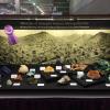
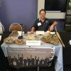
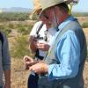
Over the past decade, AZGS's outreach efforts have included 100s of informal & formal presentations, events, field trips, classroom visits, workshops - in-person & webinars, and exhibit booths at national conferences organized by the American Geophysical Union, National Geothermal Summit, Geological Society of America, White House Datapalooza and more.
Select examples of formal and informal presentations, workshop, and media features involving the staff of the AZGS.
Allison, M.L., “EarthCube standing committees & teams: Priorities and next steps,” national webinar, July 17, 2014. [presentation repeated July 21, 2014]
Allison, M.L., “Preserving access to aggregate resources in the Phoenix metropolitan area,” Arizona Mining Alliance luncheon meeting, Tucson, AZ, August 8, 2014.
Allison, M.L., “Data integration between state and federal agencies in the U.S.,” National Data Repositories consortium general assembly, Baku, Azerbaijan, October 3, 2014
Allison, M.L., “The Digicene: the age of big data in the geosciences,” National Research Council Board on Earth Science and Resources, Program on Earth Data Science in the Era of Big Data and Computing, Washington, DC, April 29, 2015.
Caudill, C., S.M. Richard, L. Musil, A. Sonnenschein, and J. Good, J., “National Geothermal Data System” open access to geoscience data and digital technologies,” Geological Society of America Annual Meeting, Vancouver, Canada, October 20, 2014.
Conway, M., “Shake, Rattle and Roll—recent seismic activity in Arizona and the great Arizona ShakeOut,” Annual Meeting of Arizona Emergency Services, Tempe, AZ, August 20, 2014.
Conway, M., J.P. Cook, and P.A. Pearthree, “Earth fissures in Arizona outreach and education program to alert stakeholders,” Association of Environmental and Engineering Geologists 57th Annual Meeting, Scottsdale, Arizona, September 26, 2014.
Cook, J.P. and M. Mahan, “Importance and impacts of Earth fissures in Arizona and the Arizona Geological Survey Earth Fissure Mapping Program,” Association of Environmental and Engineering Geologists 57th Annual Meeting, Scottsdale, Arizona, September 26, 2014.
Gootee, Brian, “De-wrinkling the fabric: geologic structures of Northern Arizona,” Central Arizona Geology Club Meeting, Prescott, AZ, May 12, 2015.
Niemuth, N., “Industrial minerals/economic geology,” 2014 American Institute of Professional Geologists/Arizona Hydrology Society National Conference, Prescott, AZ, September 16, 2014.
Pearthree, P.A., and A. Youberg, “Wildfires, debris flows and erosion: Implications for debris-flow recurrence intervals in Southern Arizona,” Association of Environmental and Engineering Geologists 57th Annual Meeting, Scottsdale, Arizona, Sept 26, 2014.
Pearthree, P.A., “Particularly hazardous Quaternary faults in Arizona,” United States Geological Survey Intermountain West Fault Workshop, Salt Lake City, UT, January 2015.
Richard, S.M., “Design on community resource inventories as a component of scalable Earth science infrastructure: experience the EarthCube CINERGI Project,” American Geophysical Union Fall Meeting, San Francisco, CA, December 16, 2014.
Spencer, J.E., “The Plicene Bouse formation and initiation of the modern Colorado River,” Arizona State University School of Earth & Space Exploration Colloquium Series, Tempe, AZ, April 1, 2015.
Youberg, A.M., “Managing landscapes after fires- debris flows and flood hazards,” Preparing for wildfires: Moving from crisis to opportunity Tucson Fire Workshop, Tucson, AZ, March 11, 2015.
Youberg, A.M.. and Pearthree, P., 2014, “Debris Flows Shape the Sabino Canyon Landscape—Look Out Below!” Arizona Geological Society Field trip, Tucson, AZ, November 15, 2014.
Young, J., “Northern Arizona earthquakes, monitoring efforts and shaking –potential,” Flagstaff City Hall, Flagstaff, AZ, March 5, 2015.
Workshops & Town Halls
Allison, M.L, R. Black & A. Katz, Townhall: EarthCube: Community Governed Cyberinfrastructure for the Geosciences, American Geophysical Union Fall Meeting, San Francisco, CA, December 17, 2014.
Richard, S.M., GeoSciML Working Group, Tucson, AZ, June 29–July 4, 2014.
Richard, S.M., The USGIN Open Access Model for Data Sharing, One Geology South American Workshop, Rio de Janeiro, Brazil, October 24, 2014.
Media Coverage
Conway, M., “Earth fissures in south-central Arizona,” discussion on the Profiles in Community with Chris Fowling, 96.1FM KBRP, Bisbee, AZ, March 19, 2015.
Young, J., “Kachina Village aftershocks,” phone interview with KNXV-Channel 15 Phoenix News, Phoenix, AZ, May 5, 2015.
“Arizona Geological Survey: mapping Arizona” The Arizona Republic
“Rosie on the house: Make sure your Arizona home is on solid ground” Casa Grande Dispatch
“New landslide study aims to make Arizona safer” The Arizona Republic
“Arizona Geological Survey: 10 aftershocks recorded after 4.7” ABC 15 Phoenix Arizona


