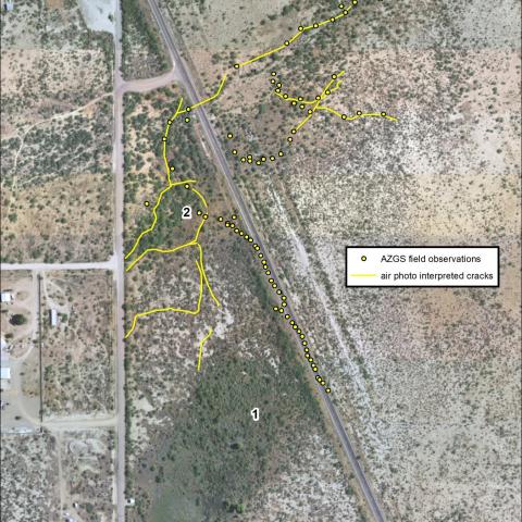
Overview of polygonal cracks and AZGS site observations. Polygonal GDC networks are present along both sides of U.S. 191 and some new cracks have formed since this aerial photo was taken (2016). Areas 1 and 2 are zones of wetted soil where rainwater infiltrates. Yellow dots represent observed surface cracks on July 8, 2021. Not all photo-interpreted cracks were visited. From J.P. Cook blog post (7/19/2021), : U.S. 191 in Cochise County damaged by extensive ground fractures (https://blog.azgs.arizona.edu/blog/2021-07/us-191-cochise-county-damaged...)
Photographer: Joseph Cook
Photo Date: July 2021
Photo Location Accuracy: Known Location
Photo Tags: cochise county, U.S. 191, GDC, giant desiccation crack, earth fissure, groundwater, drought 


