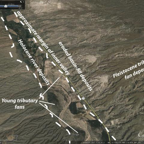
In 2007, AZGS conducted surficial geologic mapping along the San Pedro River, Aravaipa Creek, and the Babocomari River. These maps and a report are available in AZGS DM-RM-1.2. The goal of the 2013 project was to conduct site investigations along the San Pedro River to determine whether sedimentary relationships between San Pedro River and tributary alluvium are accurately represented by their mapped location on the surface. The document cited below includes a brief summary and description of 39 sites along the San Pedro River visited by AZGS geologists in late 2013 and early 2014. Includes a number of field shots annotated to express sedimentary features observed in channel walls and floor. Online resource: Cook, J.P., 2017, Site Investigation of Tributary Drainages to the San Pedro River, Arizona. Arizona Geological Survey Open-File Report (OFR) 15-02, 83 p. http://repository.azgs.az.gov/uri_gin/azgs/dlio/1724
Photographer: Joseph Cook
Photo Date: circa 2014
Photo Location Accuracy: Approximately Located
Photo Tags: Palominas Arroyo, San Pedro River, sedimentary structure, soil, tributary fan, Holocene 


